
We came at last to an oasis in the wilderness, the Lion Inn, which is perched on Blakey Ridge and has been providing sustenance to weary travelers for more than 500 years. We were not the first to arrive that day: the entryway was clogged with dripping backpacks and muddy boots. We found a table near the bar and ordered tea and soup. Our hands were so cold that we couldn't grasp coins or hold a pen to sign a credit card receipt - so we just kept a tab at the bar and warmed our fingers with our tea mugs. As you can imagine, there was a lot of mumbling and grumbling about the weather from those of us who had been out in it all morning. Going back out into the rain was not a happy prospect. We considered a bail-out option - taxi ride to our lodgings, returning the next morning - but decided that we should just push on and get it over with.
We must have made the right decision, because we then had a moment of grace. As we walked out of the Lion Inn, we found the Packhorse van which had been carrying our baggage from inn to inn throughout the trip. The side doors were open, and our bags were right in front! We began tearing through our luggage for dry clothes, socks, gloves, etc. The driver emerged from the inn and was a bit bemused to find these two half-drowned and obviously demented people ransacking his van. It was Simon, the co-owner of Packhorse, whom I had corresponded with to set up our accommodations. We made proper introductions and he nodded his head knowingly - I guess he has seen it all.
Leaving the Lion Inn, we proceeded down the road with dry socks and warm hands, and the day just kept getting better. The rain stopped, and the sun sort of came out. The C2C path followed a paved road for several miles before cutting off across the moor again. Here's a photo of the moor, with the orange tile roofs of the Lion Inn on the horizon:

Laura is happy to be dry again ...

The North York Moors are dotted with stone crosses. Across the moor from Blakey Ridge stands "Fat Betty" (sometimes referred to as White Cross). The head of the cross is an ancient wheelhead painted white, set into a large stone base half of which is also painted. It could be Norman in origin, and is one of only two known wheelheads on the North York Moors. The local custom is to leave and take an offering of food, and you can see some of the offerings below. Someone actually left an unopened can of Guinness! (We restrained ourselves and left it there.)

The moors are unfenced, so there are lambs all over the place. Slow down!

The purple heather was blooming along the roadside.

Here you can see the path setting off across the moor again. The distant valley holds the village of Glaisdale, our destination for tonight.

And here we are finally coming into Glaisdale on a farm road.

In a bizarre ending to already strange day, as we entered Glaisdale we began to encounter some odd scenes along the roadside:


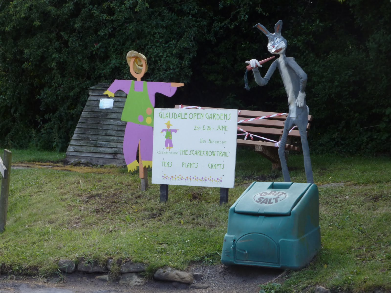
It turned out that Glaisdale was having a fundraising event which included open garden tours and a "scarecrow trail". Here is the scariest one of all:

It was a very long day, but we made it with our feet and spirits intact. Once again, we very glad to find our way to our B&B, and then the local neighborhood pub for dinner and a pint.

.
No comments:
Post a Comment