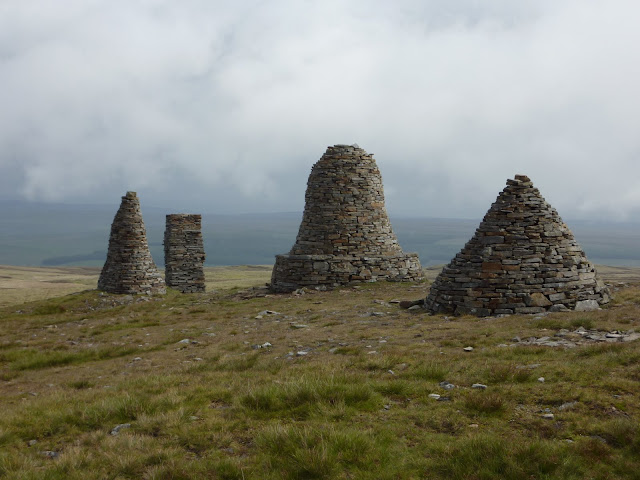
Today's hike took us out of the market town of Kirkby Stephen, over the Pennines, and into the Yorkshire Dales to the village of Keld. It was a notable day for several reasons: in crossing the Pennine Range we moved from the western to the eastern watershed of England, and reaching Keld marked the halfway point of our walk - about 100 miles from our starting point at St. Bees. The day began with ominous dark clouds and drizzle. We had hoped to take the high route past the "Nine Standards", a cluster of rock cairns on the ridge over Kirkby Stephen. However, as we climbed up the clouds moved in, and the rain came down. Here is a distant view of the Standards as we approached in the rain
So, we had to make a choice: the lower "green route" which follows the road around the ridge (boring, but hard to get lost on), or the "red route" up to the standards and over the moors. The advice is not to proceed if you can't see the Nine Standards because of low clouds or rain. We couldn't see them, so we were preparing to go the low way. As we stood in the rain and talked with other hikers, the sky started clearing, until suddenly the way was clear! It felt like a divine reward for our patience (or indecision). Anyway, we took the high route and here is the view of the Standards from the top:
Laura and I thought the this standard would look better with some color-coordinated decorations:
The trip down from the ridge across the moors was tricky. Navigation was by following the cairns, which were difficult to see even in clearing weather. In addition, this part of the trip is notorious for the breadth and depth of its peat bogs. Hikers have gone in up to their waists when thinking that they were stepping into a mud puddle. Here's a photo of a stretch of peat bog with some wisps of fog:
And here is Laura slogging through the bog. She only went up to her ankes, but I went in up to my knees at one point. I was really hoping that my boots were going to come out of the mud along with my feet!
It all came to an end eventually, and we set off on a hard tarmac road (welcome for once) for the rolling hills of the Yorkshire Dales district. This area is very rustic and beautiful. It is the site of the James Herriot novels. Here's a typical scent of the Dales with one of the old-fashioned stone barns which dot the landscape.
.
We were very happy to roll into the Keld Lodge late in the afternoon and shed our muddy clothes. The next day will take us down the Swale river valley to Reeth.


No comments:
Post a Comment