
The beginning of our second day took us along the southern edge of Ennerdale Water, a lovely calm lake surrounded by peaks. The path goes right along the water's edge, as you see here, but requires delicate footwork to avoid twisted ankles.

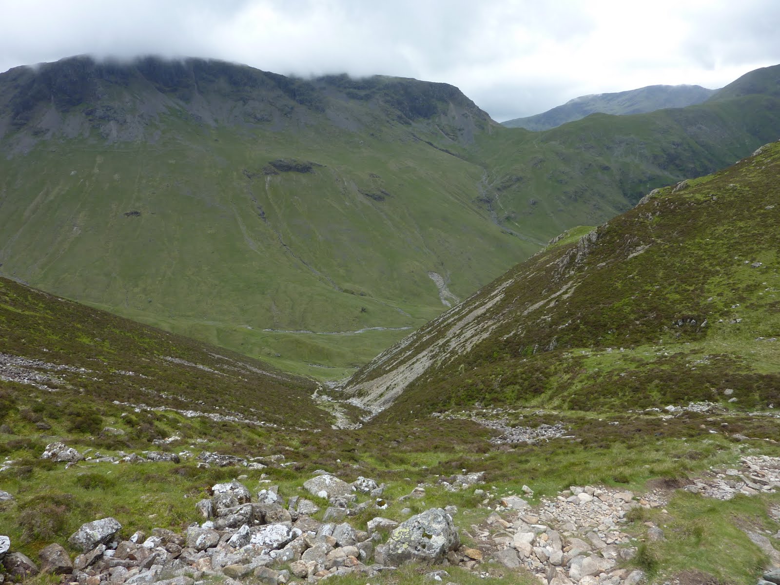
After reaching the end of Ennerdale Water, the trail climbs gently on a forest road until reaching the high valley you see below. The Black Sail Youth Hostel is visible on the left. From there, the path follows a tiny stream called Loft Beck up to the ridgetop.

Here's a view of Black Sail, the most remote hostel on the C2C path. The caretaker was out, but the hostel was open, with tea supplies available for a contribution to the "honesty box." We aired our feet and enjoyed some tea before embarking on the long climb ahead.

Here's the view from Black Sail to the trail's summit in the left distance. Dad is standing with Ronald, our Australian hiking buddy for the day. He is walking the C2C alone, and then will be hiking other trails in the UK for the next six months. The people we meet on the trail are the best part of the experience.

Here's another view looking northwest from the top of the ridge. In the far distance is Crummock Water, and in between the lakes is the village of Buttermere. The sun was shining brightly in the valley, but up on the ridge the weather changed and we got caught in a hailstorm!

From the top of Loft Beck, the path crosses a stretch of high, flat ground which is very boggy because there is no drainage. Most walkers lose the path in this mess, and end up wandering in the right general direction until coming to a fence which can be followed to the main path. After a long, muddy walk we came to a tramway path from an abandoned slate mine, which led down into the next valley toward Rossthwaite and Stonethwaite, our destination for the night.

Below our path descends toward an active slateworks where we rejoin civilization after a day in the high country. We had been walking in the rain for several hours when we arrived, and were quite pleased to warm our fingers and tummies in the inevitable tearoom.

Following the road down the valley, we came eventually to some lovely wooded areas with little areas sectioned-off by seemingly ancient rock walls. This one was full of mossy boulders, but others were overtaken by ferns, or more commonly, sheep.

After this we headed a mile or two down the road to Stonethwaite, where we had a spectacular dinner at the Langstrath Country Inn and are now off to bed. It has been a 15 mile day, our toughest so far, and our dogs are barking!

No comments:
Post a Comment