
The day began with a pleasant walk through the woods past the ruin of Marrick Priory, an old convent built in the 1100s. In the photo below you can see Laura ascending "the nuns' steps" - a stretch of 375 stone slabs set into this ancient walkway to harden the path. We were told that, as the church graveyards filled up in the more populous towns to the east, coffins were carried along this path en route to burial in the spacious convent grounds. There are stone shelves along the way - "coffin rests" - for the laboring pallbearers to take a break. This was hundreds of years ago, and now there are only the smooth, worn steps and the quiet of the woods.


A word about footpaths and public access. Most of the C2C path crosses privately owned land on public footpaths. The landowners are obligated to provide access to the footpaths, even though these may cut through the middle of a barnyard, pasture, or field of crops. Usually the farmers tolerate the walkers as long as they don't trample the crops or scare the animals. Some even make a cottage industry of selling tea and soft drinks along the path - like a lemonade stand in the wilderness. Relations aren't always positive, however, and when the farmers are annoyed they have some unofficial recourse - such as putting a bull to pasture in a field where the C2C path runs. Below we see Laura having an encounter with a very large bull who planted himself dead center on the path. He wasn't moving, and Laura was the first to blink. We gave him a wide berth, having heard stories of some walkers being chased to the fences after getting too close.

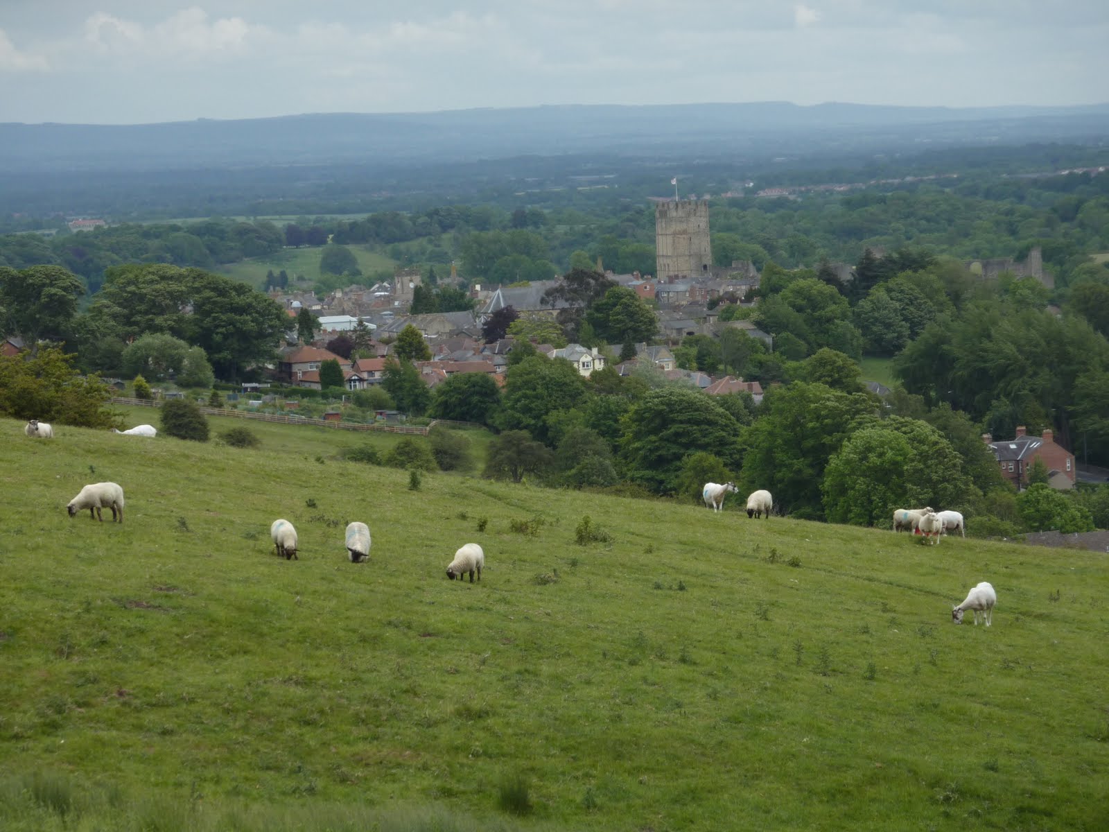
In due time we climbed over the ridge, through another lovely stretch of woods, and approached the town of Richmond on a farm road. I keep experiencing the wonder of walking into a new village or town, compared with entering by car or train. We had such a different sense of place, an awareness of the lay of the land, when walking. Here's a view of Richmond from the favorite overlook of Alfred Wainwright, the genius who designed the C2C path in the 1970s. You can see the tower of Richmond Castle in the market square in the center of town.
Here's the mandatory cute sheep shot:

And here is C2C guidance through the streets of Richmond. We will stay here tomorrow for our second rest day, and hope to tour the castle and the theatre, which is one of the oldest in England.

No comments:
Post a Comment